Results for ""
AI Research 5 Min Read Dec 05, 2024
AI aids researchers dig through old maps to find lost oil and gas wells
Researchers are using AI to dig through old maps to fun lost oil and gas wells. Undocumented orphaned wells pose hazards to both the environment and the climate. Scientists are building modern tools to help locate, assess, and pave the way for ultimately plugging these forgotten relics.
Scattered across the United States are remnants from almost 170 years of commercial drilling: hundreds of thousands of forgotten oil and gas wells. These undocumented orphaned wells (UOWs) are not listed in formal records, and they have no known (or financially solvent) operators. They are often out of sight and out of mind—a hazardous combination.
If the wells weren't properly plugged, they can potentially leak oil and chemicals into nearby water sources or send toxic substances like benzene and hydrogen sulfide into the air. They can also contribute to climate change by emitting the greenhouse gas methane, which is about 28 times as potent as carbon dioxide at trapping heat in our atmosphere on a hundred-year timescale (with even higher global warming potential over shorter periods).
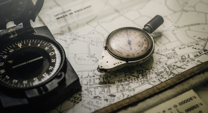
To find UOWs and measure methane emissions in the field, researchers are using modern tools, including drones, laser imaging, and suites of sensors. But the contiguous United States covers more than 3 million square miles. To better predict where the undocumented wells might be, researchers first paired the new with the old: modern artificial intelligence (AI) and historical topographic maps.
"While AI is a contemporary and rapidly evolving technology, it should not be exclusively associated with modern data sources," said Fabio Ciulla, a postdoctoral fellow at the Department of Energy's Lawrence Berkeley National Laboratory (Berkeley Lab) and lead author of a case study on using artificial intelligence to find UOWs published in the journal Environmental Science & Technology. "AI can enhance our understanding of the past by extracting information from historical data on a scale that was unattainable just a few years ago. The more we go into the future, the more you can also use the past.”
Using AI
Researchers used a digital tool to manually mark oil wells on nearly 100 maps from California and create a training set for the AI. Once taught to find the hollow circles and to ignore false positives (such as cul-de-sacs or symbols with circular patterns, like the number 9 or letter "o"), the algorithm could be applied to any of the USGS maps with the same symbols. And because the maps were georeferenced, the algorithm could take the coordinates for the oil wells marked on the map and compare them with coordinates for documented wells.
To detect a potential undocumented orphaned well, the team selected well symbols that were more than 100 meters from a known well to account for potential errors in well coordinates. They also built a novel tool that lets a human quickly vet what the algorithm finds, double checking that the AI is correctly interpreting the symbols on the map.
Researchers used the AI algorithm to scour four counties of interest that had substantial early oil production—Los Angeles and Kern counties in California, and Osage and Oklahoma counties in Oklahoma—and found 1,301 potential undocumented orphaned wells. So far, researchers have verified 29 of the UOWs using satellite images and another 15 from surveys in the field; additional investigation on the ground will be needed to confirm other potential wells.
Map, field and sky
The first pass at verifying an undocumented well happens remotely. Researchers consult satellite images and historical aerial photos, looking for features like oil derricks and pump jacks (or their shadows), lifting equipment, oil pads, storage tanks, or disturbed ground.
CATALOG aims to improve ways to find wells, detect and measure methane, rapidly screen wells for their condition, unite information from different sources, and prioritize wells for plugging. The goal is to create tools (like AI well prediction) that can be used anywhere in the United States and are inexpensive enough to be adopted.
Researchers in CATALOG are also investigating ways to scale up undocumented well detection and verification using drones equipped with different sensors. Preprogrammed with set fly routes, the drones can semi-autonomously survey a larger area than researchers could easily access on the ground.
Groups are pursuing several different kinds of sensors, each with their own challenges and benefits. To use a magnetometer from a drone, researchers have to suspend the sensor from a 9-foot cable. If it's placed closer to the drone, the electronics will interfere with capturing the magnetic signature from a well.
A separate drone carries a methane sensor that sips air as it flies, and can factor in methane concentration, wind speed, and wind direction to pinpoint a well location. Yet another technique is flying hyperspectral cameras that look for wavelengths (not visible to human eyes) associated with plumes of methane. And Berkeley Lab researchers are developing a drone-mounted technology that can pick up hard-to-find oil wells, such as those built with wood casings or wells where the metal was stripped for other uses.


