Results for ""
Computer Vision 7 Min Read Sep 29, 2022
User Submission - Computer Vision and Data Annotation: Leading the way for Drone AI

Unmanned Aerial Vehicles (UAVs) have created great ease in a number of operations and across various industries. Integrating the latest technologies has allowed for higher levels of reliability and a more reassuring degree of trust in the use of UAVs in the air. It also enables drones to capture and identify obstacles in real-time and dodge possible collisions. When deprived of computer vision, a drone only captures digital images and videos of the environment but doesn’t have the intelligence to understand and interact with its surroundings.
What is computer vision?
Computer vision is a field of artificial intelligence that trains computers to identify, interpret, and track objects in imagery and video. The technology is driven by pattern recognition. It’s trained by feeding computer models thousands to millions of images with labeled objects. This allows the algorithms to establish a profile (e.g., color, shape) for each object to then identify the things in unlabeled images.
Thanks to advances in machine learning and neural networks, computer vision has made great leaps in recent years and can often surpass the human eye in detecting and labeling certain objects. One of the driving factors behind this growth is the amount of data we generate that can be used to train computer vision models more accurately.
In many cases, machine learning and deep learning are also involved with computer vision algorithms, which increases the prediction level accuracy.
Industries advancing with Drones and Computer Vision
Many sectors resort to drones to get more work done in a shorter period of time. Here are some examples of industries that lean towards AI drone applications:
- Construction
- Farming
- Remote Area Monitoring
- Manufacturing and Industrial
- Smart cities
- Security and surveillance
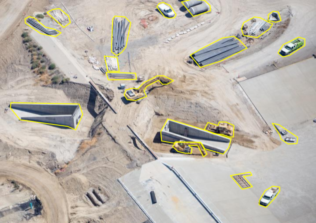
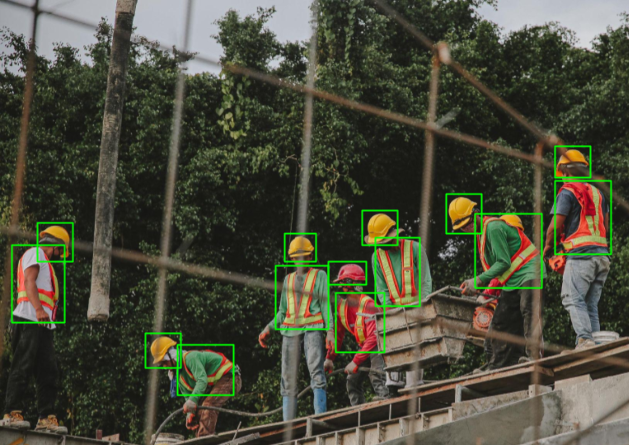
Construction Progress Monitoring
Numerous modern drone systems include real-time monitoring for improved security and on-the-spot analysis, decision-making, and planning. The creation of weekly progress maps is quicker, simpler, and less expensive thanks to drones than it would be otherwise. Additionally, they make it simpler and easier for construction companies to share information with their clients, improving communication and efficiency overall.
Agriculture
Drones provide high-resolution images that help field laborers feel less stressed. It is simple to map and survey the field and keep an eye on the plantation at all times. It also offers farmers precise data, allowing them to make well-informed decisions about pesticide application, water requirements, and soil health. The ability of drones to fly as high or as low as required makes it easier for farmers to identify potential issues that the human eye from ground level cannot see. Common applications in farming include:
1. Soil analysis and field planning
2. Standing crop tracking and counting
3. Ripeness tracking and timing the harvest
4. Weed detection

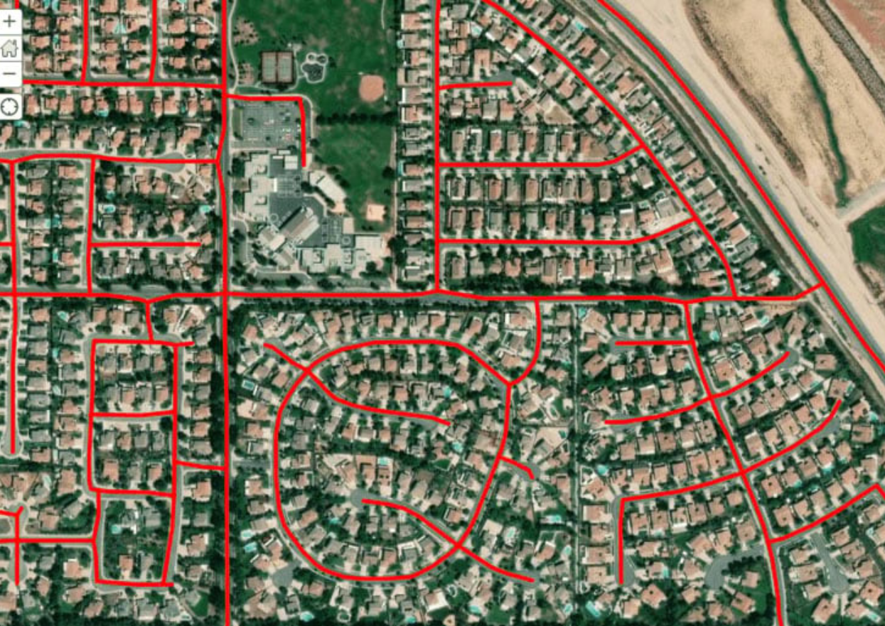
Smart City Management
Drone-based visual AI technology can be used in smart cities to detect and respond to a variety of problems more quickly, earlier, and more effectively. Cities can employ drone AI to monitor and keep an eye out for issues with transportation like traffic congestion, accidents, and slowdowns. This can facilitate faster first responder response times and give crucial telemetry data for enhancing citywide traffic flow and safety. Drone AI for smart cities may also keep an eye out for the warning signals of fires, flooding, and fire dangers. This enables cities to take preventative action or react more quickly to emergencies.

Security and Surveillance
Security drones that are used for video surveillance can perform useful and essential tasks. Drones can monitor the job sites, record aerial footage of the assets, secure perimeters, and deter break-ins to supplement human guards. When combined with AI technology, they can provide real-time data streaming around the clock. Drones can automatically recognize things that pose dangers and notify security of the threat as AI makes them smarter. Additionally, they can be set up to take particular measures immediately if they discover harmful items, weapons, perimeter intrusion, or unusual activity. They can perform remote security operations and make quicker incident response decisions thanks to AI video analytics.

Manufacturing and Industrial Safety
Users can routinely employ computer vision drones in an industrial or manufacturing scenario to continuously monitor for cracks and leaks in vital infrastructure items including pipes, storage towers, water tanks, gas tanks, and more. These devices have the ability to monitor crucial machine parts for the quick and early detection of flares and overheating. To check for certain requirements, they can fly through tunnels, mines, along pipes and power lines, or high above installations.
Monitoring hazardous and Remote areas
Drones are capable of quickly and efficiently inspecting difficult-to-reach sites, monitoring huge areas, and providing the data needed to evaluate potentially harmful situations. Drones enable better-informed decisions during bad occurrences because of their capacity to cover large regions regardless of topography, allowing them to reach closer to dangers like high voltage zones without placing people at risk of harm. An intelligent drone can fly over rapidly, spot dangers, and deliver aerial photos and live video. Security personnel can then gauge the level of danger and decide on the best course of action. Drones also come in handy to provide comprehensive coverage of the crime scene for officers to be fully briefed on the situation and assess the risk before venturing in to tackle the incident.
Types of Annotation for Drone Data
The best way to maximize accuracy and performance in drone technology is to improve your data labeled for aerial imaging. We’ve listed the most common data annotation and segmentation techniques to train computer vision models on drone data.
1. 2D Bounding Box
Bounding boxes are rectangles drawn over objects of interest in an image. 2D bounding box annotation can be used to train your computer vision segmentation algorithms to recognize, track, and avoid objects during flight.
2. 3D Cuboids
2D bounding boxes aren’t enough to inform your drone about an object’s length, width, or depth. Bringing your average bounding box into the third dimension creates a cuboid. Cuboids are essential for orienting your drone in a real-world environment. Image annotation for self-driving cars relies heavily on cuboids for the same reason.
3. Polygon Annotation
A real-world environment contains more than straight edges. To truly navigate on its own, a drone must be able to detect trees, lamp posts, fences, and rooftops. All of which can involve asymmetrical and irregular shapes. Polygon annotations provide more detail than bounding boxes and cuboids in practice, more detail translates to better drone vision. The most interesting part of polygon annotation is that it annotates the objects in irregular shapes providing the true detection of objects from an aerial view.
4. Semantic Segmentation
When it comes to machine learning image processing, image segmentation offers the most detail. Segmentation can be carried out as pixel-by-pixel annotation, considerably improving the visual accuracy of the environment that your drone will be flying over.
Particularly for detail-oriented activities like geo-sensing and monitoring deforestation, semantic segmentation is frequently used.
5. Video Annotation
Video annotation for drone training helps to recognize moving objects while flying in the mid-air. Humans running, livestock moving, or vehicles driving fast can be only recognized by drones, if trained with the right training data created by drones.
Final Thoughts
Drones and other unmanned vehicles are becoming more and more common. The development of drone systems with enhanced and refined systems has been made possible by technological advances in sectors like blockchain, artificial intelligence, and machine learning. These systems give more security, safety, and efficiency to help drone missions succeed.
Sources of Article
https://www.tagxdata.com/688/


